基本信息
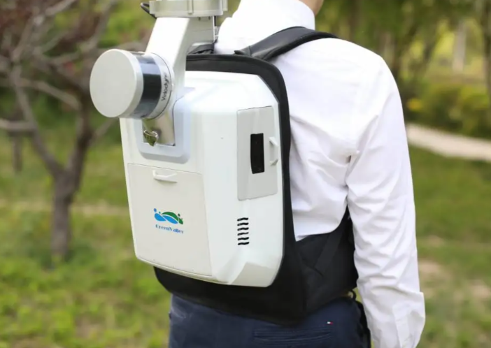
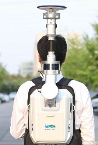
This backpack mobile 3D mapping and survey scanner is designed for large-scale outdoor mobile survey, including city street mapping, scenic area digitization, and road network survey. It addresses the pain points of traditional ground survey tools that require long working hours and limited mobility for large-area outdoor surveys. Integrated with built-in GNSS positioning modules and high-precision laser scanning modules, it delivers accurate 3D point cloud data during mobile walking survey, enabling users to create high-resolution digital twin models of large outdoor areas quickly. Suitable for urban survey teams, tourism development companies, and transportation departments, this device streamlines large-scale outdoor spatial data collection and reduces project costs.


 发布询价
发布询价


 聊天
聊天


 所有分类
所有分类