基本信息
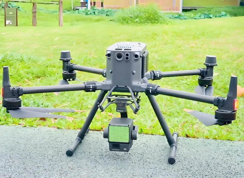
This drone-mounted 3D surveying scanner is designed for large-scale terrain mapping, forest resource census, large park planning and other outdoor wide-area survey scenarios. It is mounted on industrial-grade drones to realize non-contact, high-efficiency large-scale 3D mapping, solving the problems of high labor cost and long cycle of traditional manual ground survey. It can quickly obtain complete 3D point cloud data of large areas, providing accurate basic data for urban planning, environmental monitoring and other projects.


 发布询价
发布询价


 聊天
聊天


 所有分类
所有分类