基本信息
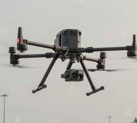
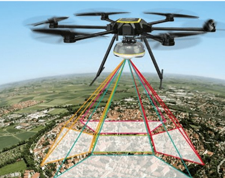
This drone-mounted aerial 3D mapping scanner is designed for large-scale terrain surveying, garden planning, and disaster assessment scenarios. It solves the pain points of traditional ground surveying which is time-consuming and has low efficiency, enabling fast and accurate 3D mapping of large outdoor areas by mounting on industrial drones. With high scalability and real-time data transmission, it is an ideal tool for large-scale geographic information collection.


 发布询价
发布询价


 聊天
聊天


 所有分类
所有分类